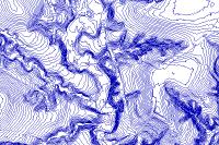
Contour 2 Ft 2017
SDE Feature Class

Tags
Bastrop, County, Texas, contours, elevation, topographic, topography, line, 2, two, foot
Contours should only be used for cartographic purposes.
This dataset consists of topographic contours mapped at an interval of 2 feet. Contours were derived from TNRIS StratMap 2017 LiDAR data (LIght Detection And Ranging) elevation points using ESRI ArcMap 3D Analyst Tools. Line smoothing achieved with PAEK smoothing algorithm set to a 3 meter tolerance.
Texas Natural Resources Information System (TNRIS), a Division of the Texas Water Development Board (TWDB); Halff Associates, Inc.; and Bastrop County, TX
Contours should only be used for cartographic purposes. Bastrop County provides this map and/or data "as is" and assumes no liability for its completeness or accuracy. Information shown on this map is derived from public records that are constantly undergoing change and do not replace a site survey. This product is for informational purposes and may not have been prepared for or be suitable for legal, engineering or surveying purposes. It does not represent an on-the-ground survey and represents only the approximate relative location of property boundaries.
Extent
West -97.664766 East -97.001911 North 30.429404 South 29.773258
Maximum (zoomed in) 1:5,000 Minimum (zoomed out) 1:50,000