Emergency Service Districts

Feature Class
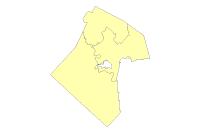
Thumbnail

Tags
Bastrop County, Emergency Response, Zones, Boundaries


Summary

Bastrop County Emergency Service Response Zones.

Description

Bastrop County Emergency Service Response Zones.

Credits

Bastrop County, Information Technology Department - GIS Division, Pecan Street, Bastrop, Texas 78602, Phone: 512-581-4012, Email: mapping@co.bastrop.tx.us

Use limitations

Bastrop County provides this dataset "as is” and assumes no liability for its completeness or accuracy. Information derived from multiple sources which are constantly undergoing change and do not replace a site survey. This product is for informational purposes and may not have been prepared for or be suitable for legal, engineering or surveying purposes. It does not represent an on-the-ground survey and represents only the approximate relative location.

Extent

West -97.656619   East -97.038835
North 30.425497   South 29.780227

Scale Range
Maximum (zoomed in) 1:5,000
Minimum (zoomed out) 1:150,000,000

ArcGIS Metadata 

Topics and Keywords 

*Content type  Downloadable Data


Citation 

Title Emergency Service Districts


Presentation formats* digital map


Resource Details 

Dataset languages* English (UNITED STATES)


Spatial representation type* vector


*Processing environment  Version 6.2 (Build 9200) ; Esri ArcGIS 10.7.1.11595


Credits
Bastrop County, Information Technology Department - GIS Division, Pecan Street, Bastrop, Texas 78602, Phone: 512-581-4012, Email: mapping@co.bastrop.tx.us

ArcGIS item properties
Name EmergencyServiceDistrict
Location withheld
*Access protocol ArcSDE Connection

Extents 

Extent
Geographic extent
Bounding rectangle
Extent type  Extent used for searching
*West longitude -97.656619
*East longitude -97.038835
*North latitude 30.425497
*South latitude 29.780227
*Extent contains the resource Yes

Extent in the item's coordinate system
*West longitude 3145659.443954
*East longitude 3334925.274411
*South latitude 9899080.883814
*North latitude 10128770.001535
*Extent contains the resource Yes

Resource Constraints 

Constraints
Limitations of use
Bastrop County provides this dataset "as is” and assumes no liability for its completeness or accuracy. Information derived from multiple sources which are constantly undergoing change and do not replace a site survey. This product is for informational purposes and may not have been prepared for or be suitable for legal, engineering or surveying purposes. It does not represent an on-the-ground survey and represents only the approximate relative location.

Spatial Reference 

ArcGIS coordinate system
*Type Projected
*Geographic coordinate reference GCS_North_American_1983
*Projection NAD_1983_StatePlane_Texas_Central_FIPS_4203_Feet
*Coordinate reference details
Projected coordinate system
Well-known identifier 102739
X origin -124805500
Y origin -81923100
XY scale 3048.0060960121928
Z origin -100000
Z scale 10000
M origin -100000
M scale 10000
XY tolerance 0.0032808333333333331
Z tolerance 0.001
M tolerance 0.001
High precision true
Latest well-known identifier 2277
Well-known text PROJCS["NAD_1983_StatePlane_Texas_Central_FIPS_4203_Feet",GEOGCS["GCS_North_American_1983",DATUM["D_North_American_1983",SPHEROID["GRS_1980",6378137.0,298.257222101]],PRIMEM["Greenwich",0.0],UNIT["Degree",0.0174532925199433]],PROJECTION["Lambert_Conformal_Conic"],PARAMETER["False_Easting",2296583.333333333],PARAMETER["False_Northing",9842500.0],PARAMETER["Central_Meridian",-100.3333333333333],PARAMETER["Standard_Parallel_1",30.11666666666667],PARAMETER["Standard_Parallel_2",31.88333333333333],PARAMETER["Latitude_Of_Origin",29.66666666666667],UNIT["Foot_US",0.3048006096012192],AUTHORITY["EPSG",2277]]

Reference system identifier
*Value 2277
*Codespace EPSG
*Version 5.3(9.0.0)


Spatial Data Properties 

Vector
*Level of topology for this dataset  geometry only


Geometric objects
Feature class name bastrop_publish.bastrop_gis_sys.EmergencyServiceDistrict
*Object type  composite
*Object count 3


ArcGIS Feature Class Properties
Feature class name bastrop_publish.bastrop_gis_sys.EmergencyServiceDistrict
*Feature type Simple
*Geometry type Polygon
*Has topology FALSE
*Feature count 3
*Spatial index TRUE
*Linear referencing FALSE


Distribution 

Distributor
Available format
*Name Shapefile


Transfer options
*Transfer size 0.066


Online source
Location withheld
*Access protocol Local Area Network
*Description  Downloadable Data


Distribution format
Name Feature Class


Fields 

Details for object bastrop_publish.bastrop_gis_sys.EmergencyServiceDistrict 
*Type Feature Class
*Row count 3


Field OBJECTID
 
*Alias objectid
*Data type OID
*Width 4
*Precision 10
*Scale 0
*Field description
Internal feature number.

*Description source
Esri

*Description of values
Sequential unique whole numbers that are automatically generated.


Field Shape
 
*Alias shape
*Data type Geometry
*Width 4
*Precision 0
*Scale 0
*Field description
Feature geometry.

*Description source
ESRI

*Description of values
Coordinates defining the features.


Field ESD_NAME
 
*Alias esd_name
*Data type String
*Width 50
*Precision 0
*Scale 0


Field esd
 
*Alias esd
*Data type String
*Width 10
*Precision 0
*Scale 0


Field DLU
 
*Alias dlu
*Data type Date
*Width 8
*Precision 0
*Scale 0


Field created_user
 
*Alias created_user
*Data type String
*Width 255
*Precision 0
*Scale 0


Field created_date
 
*Alias created_date
*Data type Date
*Width 8
*Precision 0
*Scale 0


Field last_edited_user
 
*Alias last_edited_user
*Data type String
*Width 255
*Precision 0
*Scale 0


Field last_edited_date
 
*Alias last_edited_date
*Data type Date
*Width 8
*Precision 0
*Scale 0


Field SqMiles
 
*Alias sqmiles
*Data type Double
*Width 8
*Precision 38
*Scale 8


Field st_area(shape)
 
*Alias st_area(shape)
*Data type Double
*Width 0
*Precision 0
*Scale 0


Field st_length(shape)
 
*Alias st_length(shape)
*Data type Double
*Width 0
*Precision 0
*Scale 0


Metadata Details 

*Metadata language English (UNITED STATES)
*Metadata character set  utf8 - 8 bit UCS Transfer Format


Scope of the data described by the metadata* dataset
Scope name* dataset


*Last update 2024-04-25 23:55:01


ArcGIS metadata properties
Metadata format ArcGIS 1.0
Metadata style ISO 19139 Metadata Implementation Specification
Standard or profile used to edit metadata ISO19139


Created in ArcGIS for the item 2024-04-25 23:55:01
Last modified in ArcGIS for the item 2024-04-25 23:55:01


Automatic updates
Have been performed Yes
Last update 2024-04-25 23:55:01


Thumbnail and Enclosures 

Thumbnail
Thumbnail type  JPG

FGDC Metadata (read-only) 

Identification 

Citation
Citation Information
OriginatorREQUIRED: The name of an organization or individual that developed the data set.
Publication DateREQUIRED:  he date when the data set is published or otherwise made available for release.
Title
Emergency Service Districts
Geospatial Data Presentation Formvector digital data
Online Linkagewithheld

Description
Abstract
Bastrop County Emergency Service Response Zones.
Purpose
Bastrop County Emergency Service Response Zones.
Time Period of Content
Time Period Information
Single Date/Time
Calendar DateREQUIRED:  he year (and optionally month, or month and day) for which the data set corresponds to the ground.
Currentness Reference
REQUIRED: The basis on which the time period of content information is determined.
Status
ProgressREQUIRED: The state of the data set.
Maintenance and Update FrequencyREQUIRED: The frequency with which changes and additions are made to the data set after the initial data set is completed.

Spatial Domain
Bounding Coordinates
West Bounding Coordinate-97.648858
East Bounding Coordinate-97.160167
North Bounding Coordinate30.425333
South Bounding Coordinate29.783293

Keywords
Theme
Theme Keyword ThesaurusREQUIRED: Reference to a formally registered thesaurus or a similar authoritative source of theme keywords.
Theme KeywordREQUIRED: Common-use word or phrase used to describe the subject of the data set.

Access Constraints
REQUIRED: Restrictions and legal prerequisites for accessing the data set.
Use Constraints
REQUIRED: Restrictions and legal prerequisites for using the data set after access is granted.
Native Data Set Environment
ESRI ArcCatalog 9.3.1.3000

Spatial Reference 

Horizontal Coordinate System Definition
Planar
Planar Coordinate Information
Planar Coordinate Encoding Methodcoordinate pair
Coordinate Representation
Abscissa Resolution0.000000
Ordinate Resolution0.000000
Planar Distance Unitssurvey feet

Geodetic Model
Horizontal Datum NameNorth American Datum of 1983
Ellipsoid NameGeodetic Reference System 80
Semi-major Axis6378137.000000
Denominator of Flattening Ratio298.257222

Entities and Attributes 

Distribution Information 

Resource DescriptionDownloadable Data
Standard Order Process
Digital Form
Digital Transfer Information
Transfer Size0.066

Metadata Reference 

Metadata Date2013-08-13
Metadata Contact
Contact Information
Contact Organization Primary
Contact OrganizationREQUIRED: The organization responsible for the metadata information.
Contact PersonREQUIRED: The person responsible for the metadata information.
Contact Address
Address TypeREQUIRED: The mailing and/or physical address for the organization or individual.
CityREQUIRED: The city of the address.
State or ProvinceREQUIRED: The state or province of the address.
Postal CodeREQUIRED: The ZIP or other postal code of the address.

Contact Voice TelephoneREQUIRED: The telephone number by which individuals can speak to the organization or individual.

Metadata Standard NameFGDC Content Standards for Digital Geospatial Metadata
Metadata Standard VersionFGDC-STD-001-1998
Metadata Time Conventionlocal time